


Geology Bregaglia - Casaccia
The geology of Bregaglia: where two ancient continents meet
130 million years ago, hundreds of kilometres separated the rocks now found near Maloja, which were part of the ancient African continent, from the rocks that can be observed near Soglio, which are derived from the ancient European continent. Between these two ancient continents lay a deep ocean basin, the Alpine Tethys.
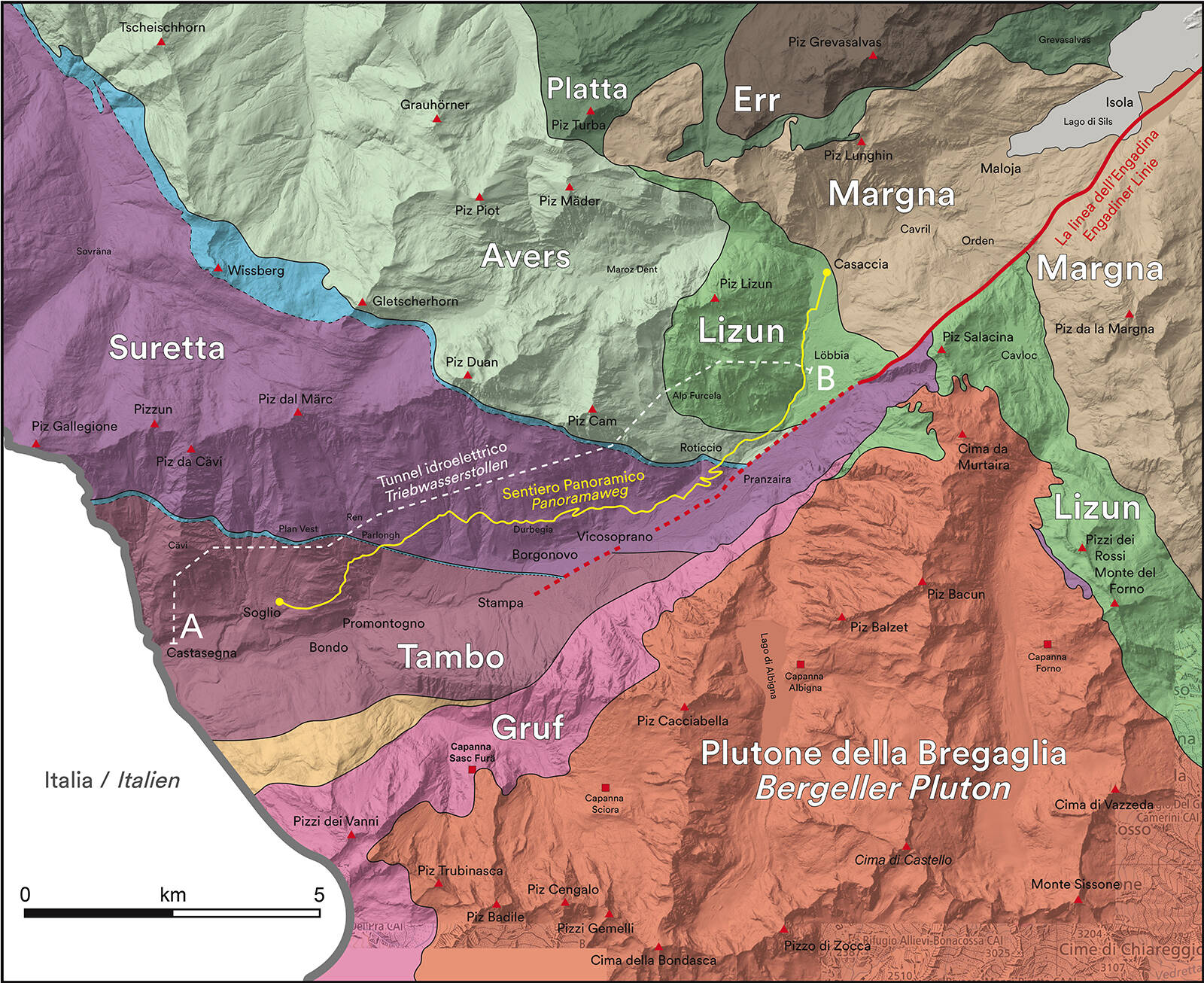
Closure of the ocean basin was followed by collision between the ancient European and African continents, culminating in the growth of the Alps between about 50–35 million years ago. During this collision, tectonic forces caused huge slices of the continents and the ocean to be thrust together. The spectacular geology of Bregaglia includes eight of these ancient geological slices: the Tambo, Suretta, and Gruf units in the west represent parts of the ancient European continent; the Margna and Err units in the east come from the ancient African continent; and the Avers, Lizun, and Platta units in the middle are remnants of the Alpine Tethys Ocean. All of these units were then intruded by the igneous Bergell pluton around 30 million years ago, which now forms the high alpine peaks on the southern side of the valley. Much more recently, a large tectonic fault called the Engadine Line cut through the valley and displaced some of the rock units.
The geological map shows the main geological units in Bregaglia. The trace of the sentiero panoramico is shown in yellow and the white dashed line shows the hydroelectric tunnel between Löbbia and Castasegna. The Engadine Line is an active geological fault which runs through the Engadine and Bregaglia valleys.
The sentiero panoramico: from an ancient ocean to a continent
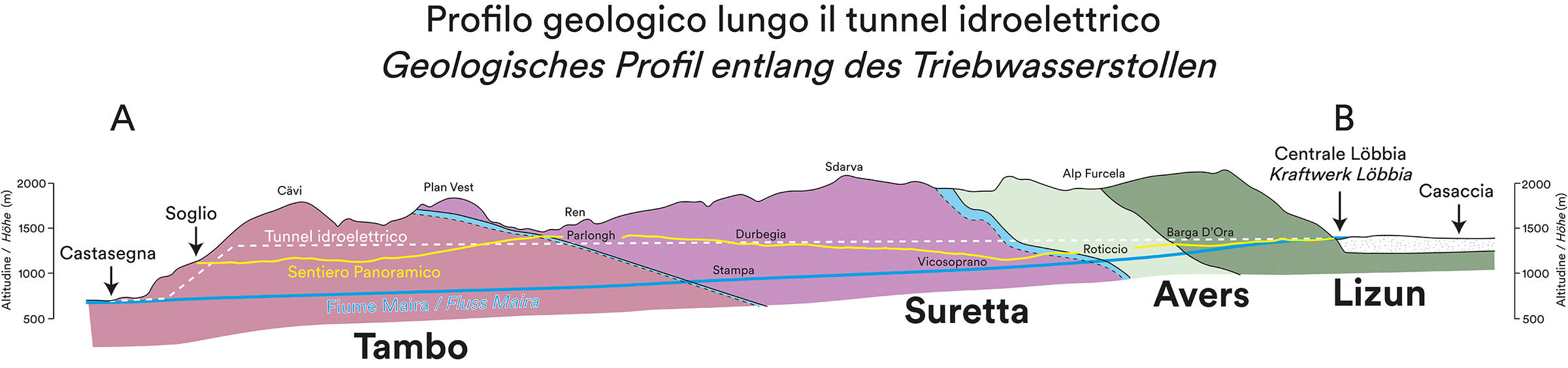
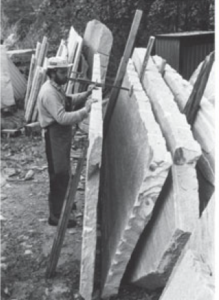
A tunnel constructed for hydroelectric purposes by EWZ between Löbbia and Castasegna runs parallel to the sentiero panoramico and allows the subsurface geology to be reconstructed in detail. Between Casaccia and Roticcio, you will walk through the green and grey Lizun and Avers units, which originally formed the oceanic crust and sediments on the deep ocean floor before undergoing metamorphism during the growth of the Alps. Between Roticcio and Parlongh, you will walk through the Suretta Unit, and from Parlongh to Soglio the Tambo Unit. The Suretta and Tambo units come from the ancient European continent and comprise grey, yellow and pink metamorphic schist and gneiss. The strongly layered Tambo gneiss has long been quarried in Soglio and Promontogno for use as roofing stones.